

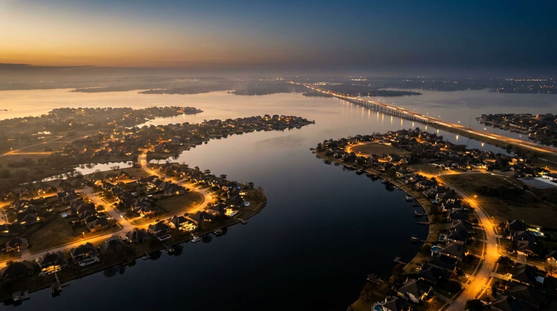

Lake Ray Hubbard is the reason most of our clients looked at Rockwall County in the first place. It is also the part of a purchase here with the most paperwork that nobody mentions until the option period. This guide explains who owns what, what a waterfront owner actually controls, and the three tiers of "lake home" that listings blur together. Facts link to the agencies that set the rules.
The lake itself
Lake Ray Hubbard is a water-supply reservoir on the East Fork of the Trinity River, owned by the City of Dallas and operated by Dallas Water Utilities. Impoundment began in December 1968 and the dam was completed in January 1969. At its conservation pool elevation of 435.5 feet above sea level the lake covers 20,947 acres and holds 439,559 acre-feet, and it extends into Dallas, Kaufman, Collin and Rockwall counties (Texas Water Development Board, Lake Ray Hubbard). Texas Parks and Wildlife lists a maximum depth of 40 feet, a normal fluctuation of one to three feet, stained water, and hybrid striped bass and blue catfish as the most abundant sport fish (Texas Parks and Wildlife, Lake Ray Hubbard).
Two of those facts matter for buyers. The lake is a municipal water supply first, so Dallas sets the rules for anything built on or near it. And the one-to-three-foot fluctuation means the shoreline you see at a showing in May is not the shoreline in September.
Who owns the shoreline
When Dallas built the reservoir it bought land to a surveyed contour above the full pool, called the take line. The strip between the water and the take line is the take area, and Dallas still owns it. Under an interlocal agreement, Dallas leases the take area within Rockwall's limits to the City of Rockwall, which has done so since a lease dated January 16, 2001 (City of Rockwall, interlocal agreement with Dallas). Rockwall then subleases pieces of it to the owners of the adjoining lots. Heath runs the same arrangement under a 2004 agreement (City of Heath, sublease program).
So a "waterfront" owner in Rockwall or Heath owns a lot that ends at the take line, holds a sublease on the strip in front of it, and uses the water under Dallas's rules. The sublease transfers with the home, and in Heath's permit paperwork any permitted structures transfer to the buyer at sale. Ask for the sublease, the annual lease payment and the permits for every structure before the option period ends. If the seller cannot produce them, that is a finding, not a formality.
Docks, seawalls and what they cost to permit
Rockwall's take line page spells out the sequence. Permits for take-area improvements go only to owners who already hold a take line lease, and only for detached single-family lots at least 45 feet wide at the front building line (35 feet on a curve or cul-de-sac). A boat-related structure needs a seawall permit from the city's engineering department first, a structural engineer's sealed design, a survey once the four outer posts are set, and an engineer's letter to close the permit. The city's fee schedule lists boat-related structures at $0.80 per square foot with a $125 minimum, retaining walls at $125 and seawalls at $75, with decks, gazebos and stairs that exceed the overlay standards requiring a Specific Use Permit from City Council (City of Rockwall, takeline). Dallas Water Utilities must also concur, and in Heath the application asks for proof that you hold a valid sublease and own the adjoining lot (City of Heath, lake structure permit).
Those are permit fees, not construction costs. Seawall and dock construction prices come from contractors and change with steel and lumber; we are glad to share recent quotes from client projects in a conversation, but we do not publish a number we cannot source.
Three kinds of lake home
Listings use "lake" loosely. These are the tiers we use with clients, from most to least expensive:
- Waterfront. The lot backs to the take line and the owner holds the sublease in front of it, with a dock or the right to permit one. In Rockwall these are concentrated on the south shore around Chandlers Landing and the coves north of the Harbor; in Heath, along the shoreline subdivisions and Heath Golf and Yacht Club, which holds 787 acres on the lake (Heath Golf and Yacht Club).
- Lake access. A home in a community with a marina or community boat slips but no private shoreline. Chandlers Landing's marina at 1 Harborview Drive and its yacht club, relaunched in 2014, are the model (Blue Ribbon News, 2014). Heath Golf and Yacht Club offers guest boat slips for day use.
- Lake view. A home that sees the water from an elevated lot or across a park, with no shoreline rights. The Harbor and Lakeside condominiums and the hillside above them are the clearest example. The view is real; the sublease and the dock are not part of the deal.
The price gap between tiers is large and specific to each cove, so we do not quote a per-foot premium. What we can say is that the shoreline sublease is the asset: two homes of the same size on the same street, one with a permitted dock and one without, do not sell for the same money.
Questions to ask on a waterfront showing
- Where exactly is the take line on this lot? Ask for the survey that shows it.
- Is there a current sublease in the seller's name, and what is the annual payment?
- Does every structure in the take area have a closed permit? Dock, seawall, stairs, lighting, irrigation and fencing are each listed on Rockwall's fee schedule.
- How deep is the water at the dock at conservation pool, and what happens at three feet below it?
- Has the seawall been inspected, and by whom?
Each of these can be settled during the option period, which is why we negotiate a longer one on waterfront contracts.
The public lake
You do not have to own shoreline to use the lake. Rockwall's Harbor district has a public amphitheater and tie-up marina, and the city's free Concerts by the Lake have run there since 2007 (Texas Legislature, H.C.R. 42). Heath's Terry Park is the city's public lake access, with a paved lakeside trail (City of Heath). The State Highway 66 boat ramp anchors several of the city's suggested trail routes (City of Rockwall, parks and trails).
For the towns' other differences, read Rockwall vs Heath. The Rockwall and Heath guides list the team's current listings, including any waterfront ones. If you own on the lake and are weighing a sale, a valuation from an agent who has priced the sublease and dock separately will land closer than any online estimate; here is why.